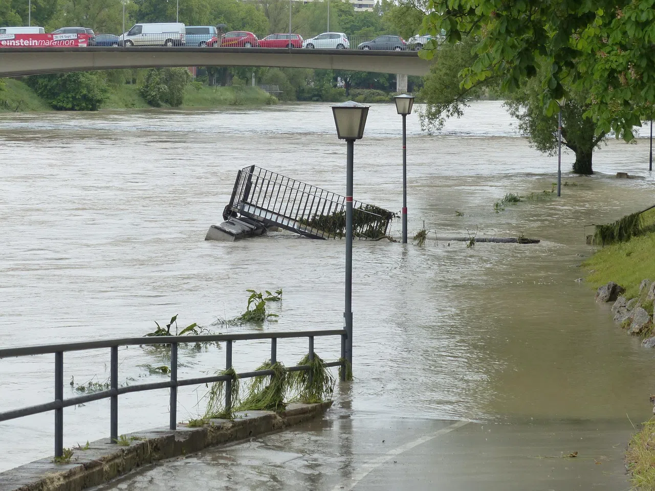
As parts of Texas face catastrophic flooding, a Canadian climate expert says outdated infrastructure and planning tools could leave communities here equally exposed to future storms.
Blair Feltmate, head of the Intact Centre on Climate Adaptation at the University of Waterloo, said most Canadian flood risk maps are between 20 and 25 years out of date—leaving cities unprepared for the growing severity of climate-driven weather events.
“When large precipitation events occur, what we don’t have is a good delineation on where water is going to go,” Feltmate said in an interview. “And that’s particularly true in urban and suburban areas.”
Without accurate and current mapping, municipalities can’t properly plan stormwater defences or restrict development in high-risk flood zones. Feltmate said that leads to unsafe decisions around where new homes and infrastructure are built—decisions that may seem safe today, but could prove disastrous in 25 to 50 years as climate patterns shift.
In contrast to Texas, where record rainfall and overwhelmed drainage systems are displacing residents, Canada does have some tools and knowledge in place. Ontario, for example, operates 36 conservation authorities with the legal power to prevent building on floodplains. But Feltmate said no such bodies exist in the nine other provinces, where municipalities often make floodplain decisions on their own.
“In some cases, you have a mayor or council that may not even believe climate change is real,” he said. “They can allow homes to be built in vulnerable areas simply because flooding hasn’t happened there yet—or because they want the tax revenue from new development.”
Feltmate pointed to 1954’s Hurricane Hazel as a wake-up call for Ontario, where 84 people died in floodwaters that swept through the Greater Toronto Area. The storm prompted the province to set up its conservation authority system, which remains a national model for floodplain management.
However, he warned that history may repeat itself in other parts of Canada without proactive measures to modernize maps and implement long-term planning.
“The risk is real,” he said. “We know what to do at both the household and community levels—but we need updated tools and political will to act.”
Feltmate advocates for modernized flood maps made accessible to homeowners, engineers and planners, along with investment in natural and engineered defences like berms, holding ponds, bioswales and permeable surfaces.
“Flooding is Canada’s most frequent and costly climate threat,” he said. “Without better planning, we’re just waiting for our own version of what’s happening in Texas.”
