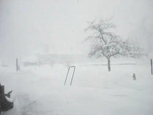
Londoners should expect strong winds, poor visibility and possible road closures.
Environment Canada has issued a snow squall watch for London and all of Middlesex County.
The warning came just after 3:10 p.m. Wednesday.
The national weather agency says snow squalls are expected to develop off Georgian Bay and Lake Huron late Thursday morning and continue through Friday afternoon.
Monica Vaswani, a severe weather meteorologist with Environment Canada, says the most intense bands will likely take place Thursday night with conditions slowly improving Friday.
“(The city) could potentially see 5 to 10 centimeters of snow (on Thursday), it’s not out of the question.”
Snow has arrived in southern Ontario, with heavier amounts looming for later in the day due to lake-effect snow. #ONstorm #ONsnow
— The Weather Network (@weathernetwork) November 7, 2019
Vaswani says there’s a chance that the city will be covered in snow on Remembrance Day.
“Remembrance Day being Monday, it does look like another lake effect event will set up, so you’ll likely see very similar conditions with northerly winds and snow squalls.”
Vaswani is advising drivers to avoid the road for unnecessary travel due to the risks involved with poor visibility.
“Visibility can reduce very quickly. You can go from sunny skies to visibility less than 200 metres in front of you.”
Londoners could see a total snowfall accumulation of 20 to 30 centimetres by Friday morning, according to Environment Canada.


